- automotive internet GPS systems
- plans of cities with geoportal centers
- crisis command
- in industry information systems
We map the world
We map
the world
the world
01
Tukaj Mapping
We specialize in computer processing and development of aerial and satellite images as well as creation of integrated GIS and SIT information systems. Technologies used by us have been recognized for many years as the world's leading ranking of digital cartography systems.
02
Our mission
Our mission is to provide clients with system solutions supporting decision making processes at all management levels based on spatial information.
TMCE
OFFER
Computerisation of public administration resources

Digital Terrain Model (DTM) and Digital Surface Model (DSM)
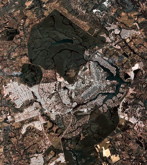
Orthophotomap
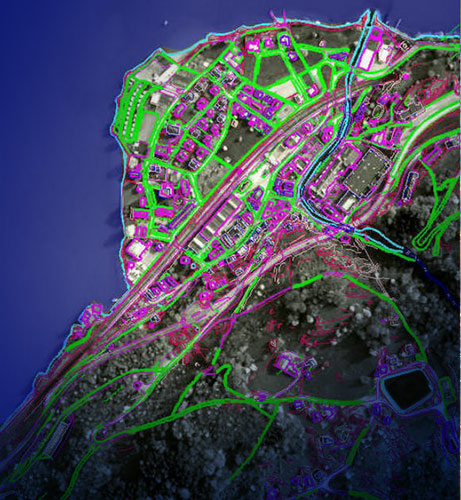
Geographic Information Systems
LiDAR Intensity Images
Inventory of energy networks
Computerisation of public administration resources
Digital Terrain Model (DTM) and Digital Surface Model (DSM)
Orthophotomap
Geographic Information Systems
LiDAR Intensity Images
Inventory of energy networks
Our projects
Application
The products we create are applicable in many areas of our lives becoming more and more available and widespread. The acquired vector data of objects can be found in: